The IxDA interaction conference is taking place in Dublin this year and the conference’s branding features a network diagram of world cities and their respective physical distances from Dublin.
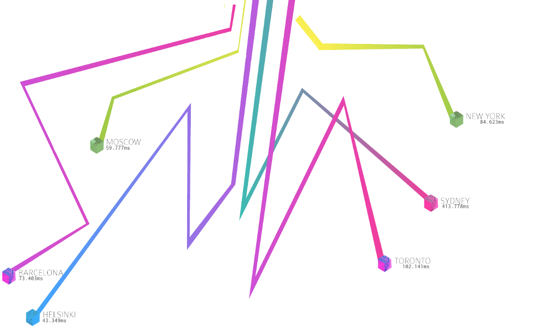
It occurred to me that given that we are more often connected with each other electronically rather than physically that time rather than the physical distance might be a more relevant measure of connections between our cities. So I though that it would be interesting to replace the distance in km in the site graphics with the time in ms it took a IP packet to travel from Dublin to these world cities.
Time is the longest distance between two places
Tennessee Williams
So I quickly hacked together a browser plugin and a bookmarklet that would replace the distance in km in the site graphics with the time in ms it took a IP packet to travel from Dublin to these world cities.
The implementation was pretty straightforward, I download the 2 background images from the site noting the position and then removing the km distance for each city. I then created an array of all the cities with the pixel coordinates within the images along with a IP address for a server in that city. I then create a script which upon each request would ping the servers and compose an image with the average ping time for each city. Finally I made a browser plugin and a bookmarklet which would replace the image on the site with these new images.
So pop over to this page and grab the bookmarklet, then visit the conference website and click the bookmarklet to see the how many millisecond these cities are from Dublin (where my my server is based).
As these image are dynamic the network times will be different each time they are loaded !
Update
A recent server move left me unable to execute ping commands, so unfortunately this script is now on a server in France.